Viewing the map
The Map page allows you to see a visual of your jurisdiction. You have the ability to use your parcel layer in SmartGov to easily locate parcels, carry out a proximity search, and create records for a specific parcel from this view.
- Click Workspace in the navigation menu, then select Map.
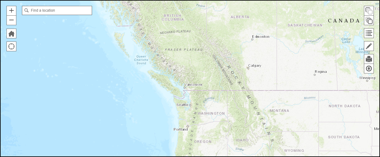
- A map will display. *Note: The default view, ArcGIS Server information, Map Layers, and Base Maps are set up on the Mapping Setup page.
- Search for a specific location by using the Find a Location search bar in the top left corner of the map. *Note: The locations and addresses found through this search are pulled from Esri. They may not match the parcel data you have in SmartGov.
- Click the Change Basemap icon (
 ) to change the map view.
 - Click the Change Layers icon (
 ) to display additional map layers on the map view. *Note: These layers are typically set up during the initial implementation of SmartGov through the GIS Connector.
 - Click the View Legend icon (
 ) to view a legend describing what each colored marker on the map represents.
 - Click the Draw icon (
 ) to make any annotations on the map. You can draw shapes, add text to the map, or mark individual points.
- Once you have made any necessary changes to the map view, you can click the Print icon (
 ) to print the map view or click the Download Image icon (
 ) to save the image of the map to your computer.
Working with the map
If a parcel layer has been added to SmartGov, you can use the map view to locate a parcel, create and view any records associated with the parcel, and carry out a proximity search for parcels within a certain distance of a specific parcel.
Viewing a parcel
- Ensure the Parcel layer is on by clicking the Change Layers icon (
 ) and checking the box beside your parcel layer.
 - Use the Find a Location field to search for the location. The location will be marked with a map pin (
 ). *Note: The locations and addresses found through this search are pulled from Esri. They may not match the parcel data you have in SmartGov.
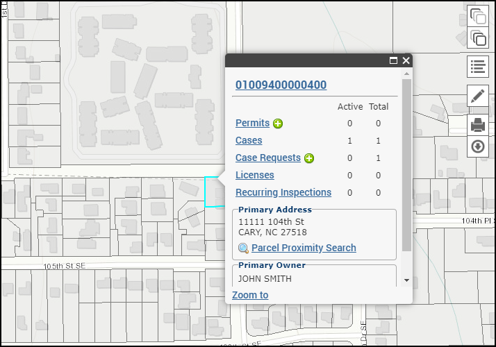
 - Click the parcel on the map to view the parcel number, the number of Active records, the Primary Address, and the Primary Owner.
Creating and viewing records from the parcel layer
After selecting a parcel on the map, the number of Active records and the Total number of records will display.
- Click the plus sign icon (
 ) to create a Permit application or a Case Request associated with this parcel.
 - Click a record type, such as Permits or Licenses, to view the Associations tab of the selected parcel.
- From the Associations tab, click on a record number to view the record.

Proximity search
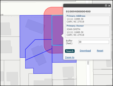
A proximity search can be useful if a notice needs to be sent out to all parcels within a certain distance of another parcel. For example, if construction is occurring at a specific parcel and all parcels within 30 feet need to be notified, you can run a proximity search and print the results that list who should receive the notice.
- After selecting a parcel on the map, click Parcel Proximity Search in the Primary Address section.
- Enter the Buffer (in feet) to search for any parcel within the distance entered.
- Click Search. The map will display a buffer around the selected parcel. Any parcels within the buffer will be highlighted.
- Click Download to generate an Excel file with the matching results.