Creating GIS data from Asset Essentials
When creating a work order from the map in Asset Essentials, a GPS data point becomes associated with that work order. Following the steps below will demonstrate how to take those data points out of Asset Essentials in order to create new GIS data using ArcMap. *Note: The GIS Asset Management feature is available to Asset Essentials clients for an additional cost. Please contact your Sales Representative or Client Services if you are interested in purchasing this feature.
Exporting GPS points from Asset Essentials
The first step in creating GIS data from Asset Essentials is exporting the GPS data points to an Excel document.
- Click the Work Orders menu icon, then click on Work Orders.
- Use Advanced Filters or the individual column filters to narrow down your work order list so that it only includes the work orders that you want to export.
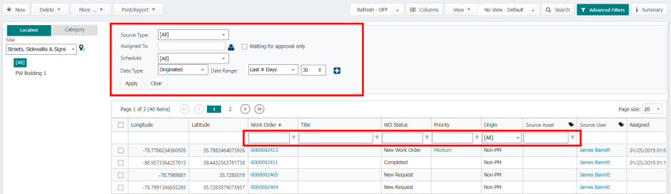
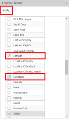
- Click on the Columns button, then click the arrow next to Work Order Fields.
- Check the boxes next to Latitude and Longitude, then click Apply.
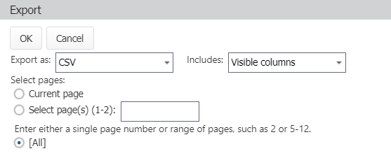
- Click the More button at the top of the Work Orders page, then select Export.
- In the pop-up window, select the following:
- Export as: CSV
- Includes: Visible Columns
- Select pages: All
- Click OK to export the file.
Creating GIS data from Excel
Once your GPS points have been exported from Asset Essentials, the next step is to turn them into GIS data using ArcMap.