Web Portal Login and Layout
- Open your web browser and type map.mobile311.com into the address bar and hit the Enter key. Bookmark this page or create a shortcut on your desktop to make it easy to come back to this page later.
- On the Account Login screen, enter your User Name and your Password.
- Click Sign In.
Web Portal Layout
There are 4 main sections to the Mobile311 Web Portal.
Toolbar
The toolbar controls how you interact with the map and data points. Click on a tool to activate it. Initially, the Zoom In tool is activated after log in; you can double-click
directly onto a selected area on the map to get a closer view.

| Icon | Feature | Description |

|
Street Map | Allows user to switch Map from Street view to Satellite view. |

|
Initial Extent | Returns the map to the level of the zoom at login. |

|
Zoom to Previous Extent | Returns to the previous extent. |

|
Zoom to Next Extent |
Moves to the next extent. |

|
Zoom In | Click a point on the map and stretch the red selection box over the area you want to zoom in on. |

|
Zoom Out | Click a point on the map and stretch the red selection box over the area you want to zoom out on. |

|
Fixed Zoom In | Zooms in by a fixed increment. |

|
Fixed Zoom Out | Zooms out by a fixed increment. |

|
Pan | Click and drag to scroll across the map. |

|
Flagging Tool |
Starts a new work item. |

|
Select Tool | Selects a single point or uses a lasso to select many points |

|
Identify Base Data Tool | Displays base map data, which comes from your linked GIS information. |
|
|
Clear Selection | Erases the current selection of data points. |

|
Measure | Calculates length and area of segments |

|
Print Map | Prints current view of the map (with or without the legend). |

|
Insight Dashboard | Opens an administrative reporting tool in a new browser window. |

|
Report Submenu | Access a list of available reports. |
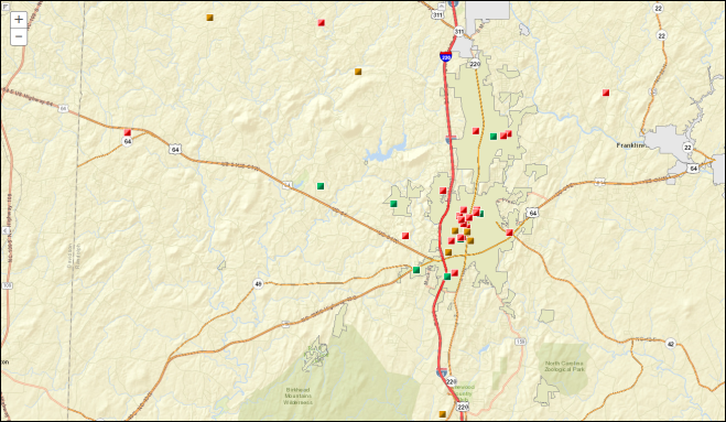
Map
The Map displays a selected area (extent). Work Items within that extent appear as dots or other shaped graphics.
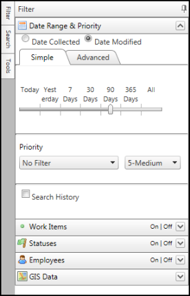
Sidebar
The Sidebar contains the Filter, Search, and Tools tabs that allow you to modify the Map view.
|
Side Tabs - Click on each Sidebar tab to add the corresponding data layer to the map.
Filter Headers - These headers appear when you click on the Filter side tab. Click on a header to display those options.
Collapse Sidebar - Using the pushpin feature (
|
 ) allows the Sidebar to be docked in the expanded position until you are ready to close it. Each layer of the sidebar (Filter, Search, and Tools) has its own pushpin.
Data Grid
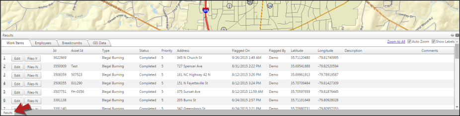
The Data Grid displays map information by using certain tools and search functions. Data selected on the map displays in the Data Grid as a detailed list, with up to 100 items. Data is separated into categories of Work Items, Employees, Breadcrumbs, and GIS Data. Click on the Results tab at the bottom of the screen to open the Data Grid.